Skip to content
Chronicle

Search History Omakase

Start typing to search.

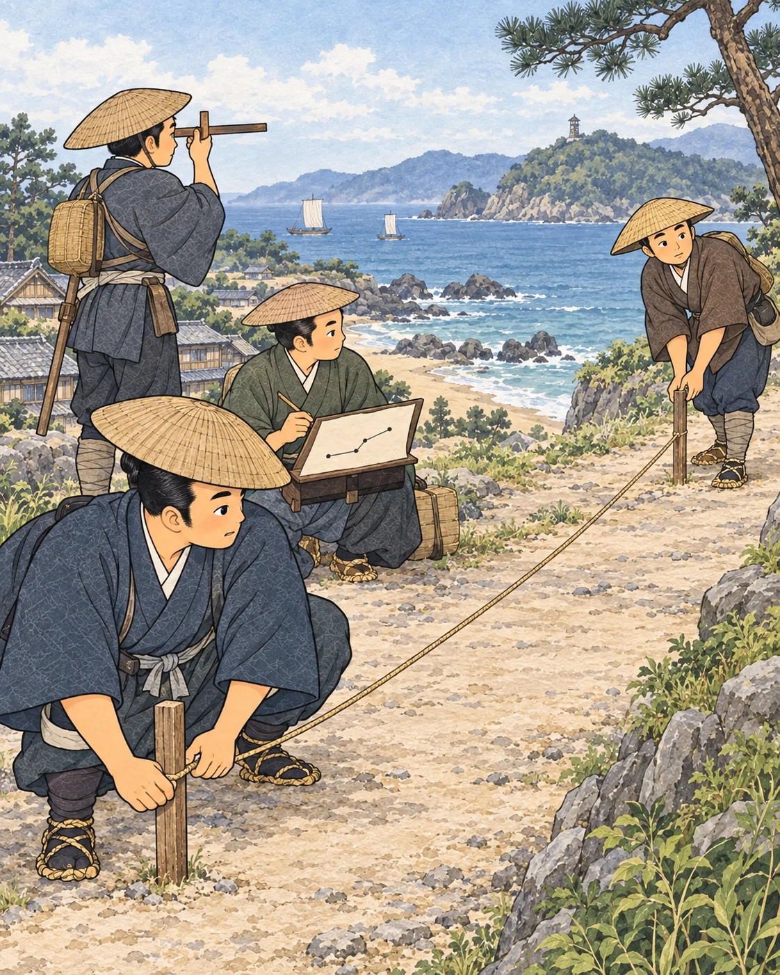
    Illustration for How Inō’s Survey Parties Measured the Coast

    1800–1816 | Edo period

    How Inō’s Survey Parties Measured the Coast

    伊能測量隊の沿岸測量

    Choose a reading depth

    Overview

    Inō’s parties measured routes in consecutive sections. Each length was recorded together with its direction, so the sections could be connected on a drawing. This traverse method followed roads and coastlines that people could physically survey; it was different from treating the whole country as one measured triangle network.

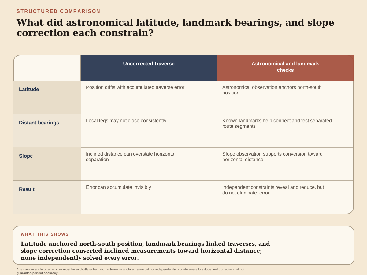
    Field observations checked the accumulating route. A quadrant supplied astronomical latitude from the sky, and bearings toward distant mountains or other landmarks helped relate separate positions. Slope measurements allowed inclined lengths to be converted into their horizontal equivalents. These procedures reduced errors that would otherwise accumulate as one short section followed another.

    The surveys continued from 1800 to 1816, with growing government involvement after the early work. Inō did not personally accompany every later party: the ninth survey, to the Izu islands, proceeded without him. Field records then required drawing and compilation. The map’s achievement depended on this repeated work by parties and office staff, as well as Inō’s planning and calculation.

    Read How Inō’s Survey Parties Measured the Coast

    Read the article below. Interactive reading tools are available when scripts load.

    Quick

    How Inō’s Survey Parties Measured the Coast

    Inō’s parties measured routes in consecutive sections. Each length was recorded together with its direction, so the sections could be connected on a drawing. This traverse method followed roads and coastlines that people could physically survey; it was different from treating the whole country as one measured triangle network.

    Field observations checked the accumulating route. A quadrant supplied astronomical latitude from the sky, and bearings toward distant mountains or other landmarks helped relate separate positions. Slope measurements allowed inclined lengths to be converted into their horizontal equivalents. These procedures reduced errors that would otherwise accumulate as one short section followed another.

    The surveys continued from 1800 to 1816, with growing government involvement after the early work. Inō did not personally accompany every later party: the ninth survey, to the Izu islands, proceeded without him. Field records then required drawing and compilation. The map’s achievement depended on this repeated work by parties and office staff, as well as Inō’s planning and calculation.

    Question: Why was a younger government astronomer more important than Tadataka's decades of practical experience?

    Experience transfers selectively. Tadataka knew accounts, weights, routes, labor, and negotiation. Astronomical measurement required a different error culture. An observation had to be timed, an angle read, an instrument adjusted, a table consulted, and a calculation compared with theory. Confidence earned in commerce could become dangerous if it replaced instruction.

    Takahashi Yoshitoki worked in the shogunate's astronomical office, the Tenmongata. The office's responsibilities included calendars, a domain in which an error affected ritual dates, agriculture, and government authority. Calendar reform demanded observation and engagement with technical knowledge transmitted from China and Europe.

    Yoshitoki's generation did not simply import “Western science” whole. Texts traveled through languages and institutions. Concepts were translated, compared with inherited astronomy, recalculated, and fitted to available instruments. Knowledge production was East Asian and collaborative.

    Hazama Shigetomi and instrument-making networks form part of this ecology. Precision depended on metal, wood, scales, sighting devices, and craft. A quadrant could embody mathematical design, but a poorly divided arc or unstable mounting would corrupt readings. Artisans belong in the scientific graph.

    Classic

    Conditions behind How Inō’s Survey Parties Measured the Coast

    Inō’s parties measured routes in consecutive sections. Each length was recorded together with its direction, so the sections could be connected on a drawing. This traverse method followed roads and coastlines that people could physically survey; it was different from treating the whole country as one measured triangle network.

    Question: What had to be completed before Tadataka could become a beginner again?

    Retirement in an early modern house was a managed succession. The outgoing head could retain influence, property rights, or advisory roles, but daily responsibility had to pass to an heir able to preserve credit and family continuity. Tadataka's 1794 transfer to his eldest son Kagetaka was therefore an institutional achievement.

    The change rested on decades of work. A weak household burdened by debt could not easily support an elder's study in Edo. Commercial capital paid for residence, books, instruments, travel, and the early surveys to which Tadataka contributed substantial funds. The freedom to become a student was economically produced.

    Intellectual curiosity also predates the retirement date. On a 1793 journey that included Ise, surviving travel material records observations of latitude and direction. He had studied calendrical matters independently in Sawara. Fifty marks a move and a new teacher, not the first appearance of the sky.

    This chronology corrects a popular before-and-after image. Tadataka did not spend forty-nine years indifferent to knowledge and awaken overnight. Interests intensified, resources accumulated, an heir matured, and a viable training opportunity became available. Historical transformation often proceeds through overlapping phases.

    How Inō’s Survey Parties Measured the Coast in motion

    Field observations checked the accumulating route. A quadrant supplied astronomical latitude from the sky, and bearings toward distant mountains or other landmarks helped relate separate positions. Slope measurements allowed inclined lengths to be converted into their horizontal equivalents. These procedures reduced errors that would otherwise accumulate as one short section followed another.

    The surveys continued from 1800 to 1816, with growing government involvement after the early work. Inō did not personally accompany every later party: the ninth survey, to the Izu islands, proceeded without him. Field records then required drawing and compilation. The map’s achievement depended on this repeated work by parties and office staff, as well as Inō’s planning and calculation.

    Question: Why was a younger government astronomer more important than Tadataka's decades of practical experience?

    Experience transfers selectively. Tadataka knew accounts, weights, routes, labor, and negotiation. Astronomical measurement required a different error culture. An observation had to be timed, an angle read, an instrument adjusted, a table consulted, and a calculation compared with theory. Confidence earned in commerce could become dangerous if it replaced instruction.

    Takahashi Yoshitoki worked in the shogunate's astronomical office, the Tenmongata. The office's responsibilities included calendars, a domain in which an error affected ritual dates, agriculture, and government authority. Calendar reform demanded observation and engagement with technical knowledge transmitted from China and Europe.

    Yoshitoki's generation did not simply import “Western science” whole. Texts traveled through languages and institutions. Concepts were translated, compared with inherited astronomy, recalculated, and fitted to available instruments. Knowledge production was East Asian and collaborative.

    Hazama Shigetomi and instrument-making networks form part of this ecology. Precision depended on metal, wood, scales, sighting devices, and craft. A quadrant could embody mathematical design, but a poorly divided arc or unstable mounting would corrupt readings. Artisans belong in the scientific graph.

    The immediate settlement

    Question: How could walking a route yield the size of a planet, and where could the inference fail?

    Latitude is an angle locating a point north or south. In principle, if two sites have a known latitude difference and the ground distance between their east-west parallels can be derived, the length corresponding to one degree becomes calculable. Multiplying by 360 gives the circumference of a spherical Earth.

    The principle is simple; field realization is not. A road does not follow a perfect meridian. It turns east and west, climbs, descends, crosses rivers, and detours around obstacles. Each measured segment must be assigned a direction, then resolved into north-south and east-west components.

    Distance measurement itself accumulates error. Pacing is rapid but depends on stride and terrain. Ropes or chains stretch, sag, and require standardized handling. Bearings can be disturbed by instrument imperfection and magnetic variation. Many small deviations can move the endpoint substantially.

    Astronomical latitude offers correction. Observing the altitude of selected stars or the sun at meridian passage can anchor a route's north-south position. Yet horizons, refraction, weather, clock time, and instrument division limit precision. A reading is not a direct revelation of coordinates.

    The event's longer afterlife

    Question: What did Sawara teach Tadataka that a later astronomy lesson could not?

    Sawara was a commercial settlement linked by waterways to the Tone River system and the Edo market. Goods moved through boats, warehouses, wholesalers, and village producers. A merchant there worked inside geography before drawing it: distance affected time, spoilage, price, and risk.

    Sake brewing made measurement repetitive. Rice and water had to be selected, processed, timed, stored, and sold. Fuel had to arrive. Workers had to be scheduled. A failed batch converted small errors into substantial loss. Practice rewarded records that allowed causes to be traced.

    Trade in rice, firewood, charcoal, and other goods expanded the ledger. Prices changed by season and crisis. Credit linked households over time. Transport was vulnerable to weather and water conditions. Tadataka's commercial competence was therefore quantitative and organizational, even if its aims differed from astronomy.

    Household success was collective. Family members maintained relationships and domestic production. Brewers and laborers supplied skilled and physical work. Boatmen carried goods. Cultivators produced rice. Suppliers extended credit. A biography centered on the future mapmaker can make all of these contributors disappear into the phrase “he prospered.”

    Sources and notes

    1. 伊能忠敬の生涯 · Inō Tadataka Museum
    2. 伊能忠敬の測量術 · National Diet Library
    3. 測地原稿図解説 · University of Tokyo Library

    About these sources

    Reading preferences

    Text size
    Glossary intensity

    Choose how much explanation appears as you read.

    Saved on this device. All terms remain available in the glossary.

    Browse the glossary →
    History Omakase

    Opening reading…