Otaru Port before the Canal Image
Attraction
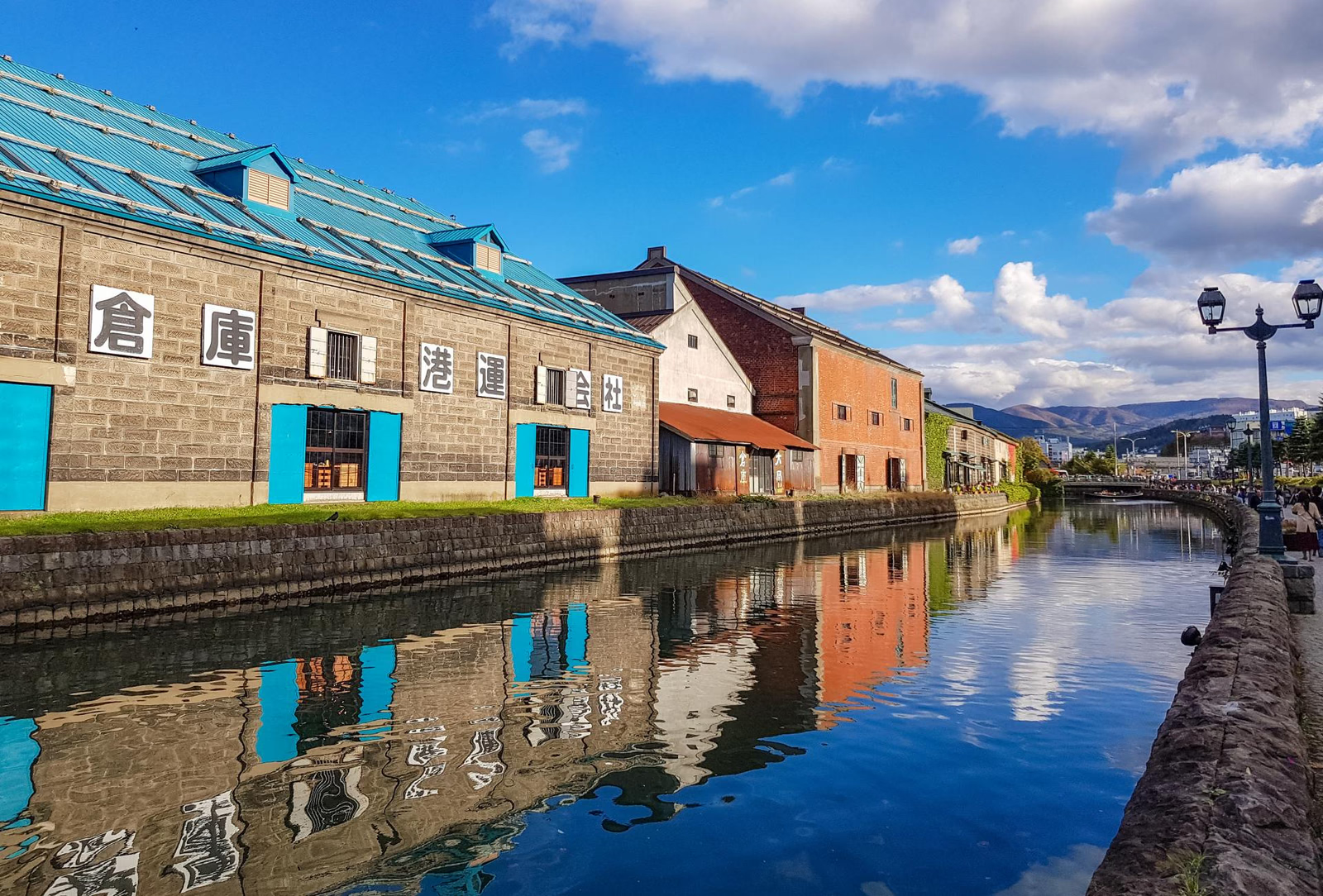
Otaru's historical logic begins with port function. Hokkaido development created demand for moving coal, fish, grain and manufactured goods, and Otaru became a major exchange point. The canal is visually famous today, but the larger historical system is the harbor itself, connected to storage, rail and inland distribution. The city grew because goods moved through it, not because a picturesque waterfront existed. Stand where the canal, warehouses and open harbor can be compared. The canal served small craft transferring cargo between ships and shore, while rail lines moved goods beyond the waterfront. Each element solved a different part of the same logistics problem. This wider frame explains both Otaru’s rapid growth and the later decline of facilities designed for an earlier transport system.
Current visibility
Otaru's port history remains visible through the open harbor, canal, warehouses, and rail relationship; no sculpture group represents the logistics system.
Warehouses are logistics architecture
Attraction
Otaru's warehouses should be read as infrastructure rather than nostalgic façades. Thick walls, shutters, loading access and repetitive storage volumes supported a city whose economy depended on moving large quantities of goods. Stone and timber construction also responded to fire risk in a rapidly growing commercial district. Commercial architecture becomes legible when you ask what had to be stored, protected and moved. Compare the long, low masses rather than only their decorative fronts. Doors and loading openings face former movement routes; fire-resistant stone or brick separates valuable cargo from the dense commercial town. Many interiors now have new uses, so their current atmosphere can obscure the original work. Exterior rhythm and orientation preserve the clearest evidence of storage and transfer.
Current visibility
The place-specific feature discussed as “Warehouses are logistics architecture” is anchored by the present landscape, the interior, and the exterior fabric, but today's access or operating condition at Otaru Port–Rail–Warehouse Historic Area requires a current official check.
Railway Infrastructure and the Port
Attraction
Otaru's port mattered because it was connected inland. The Horonai railway system linked coal-producing areas with the port, making rail and maritime shipping part of one logistics chain. The exact surviving track environment has changed, but the historical relationship remains clear: the city converted inland production into coastal shipment. A port becomes regional infrastructure only when it connects to what lies beyond the coast.
Current visibility
“Railway Infrastructure and the Port” is visible as a spatial feature of Otaru Port–Rail–Warehouse Historic Area, with the railway trace and the harbor carrying the on-site reading.
Otaru Canal and the Later Port Landscape
Attraction
Otaru Canal is indispensable to the city’s present identity, but its completed form belongs largely to the period after the main Meiji-era port expansion. Use it as a locator for the warehouse and harbor system without making every visible feature evidence of the same date. The waterfront is a layered working landscape, not a single preserved moment.
Current visibility
The present landscape at Otaru Port–Rail–Warehouse Historic Area keeps “Otaru Canal and the Later Port Landscape” legible through the harbor, rather than through one preserved interior.
Commercial Architecture above the Waterfront
Attraction
By the late Meiji period, Otaru was more than a warehouse edge. Trade generated finance, offices, shops and residential districts on the slopes behind the port. Ports create institutions beyond docks: finance, administration and urban services follow trade. Moving uphill reveals banks, offices and shops that depended on the cargo economy below. Building type and street gradient together show how maritime trade generated a broader urban service center. The district became known as the 'Wall Street of the North'; the Former Bank of Japan Otaru Branch, now a museum, is its clearest surviving anchor.
Current visibility
At Otaru Port–Rail–Warehouse Historic Area, “Commercial Architecture above the Waterfront” is grounded in present on-site evidence—the harbor, the present landscape, and the administrative landscape—without implying that every historical layer survives as fabric.
Otaru as a Logistics City
Attraction
Otaru is easiest to romanticize and easiest to understand when romance is temporarily removed. Before 1912 its historical importance came from infrastructure: ships brought and carried goods, rail connected the interior, warehouses buffered flows, and commerce grew around the resulting exchange. The surviving urban landscape is compelling because those systems remain readable beneath later tourism.
Current visibility
Otaru's logistics history remains visible across the port, rail alignments, warehouses, canal, and surviving urban fabric, not through a single interior.